THEMATIC MAPS
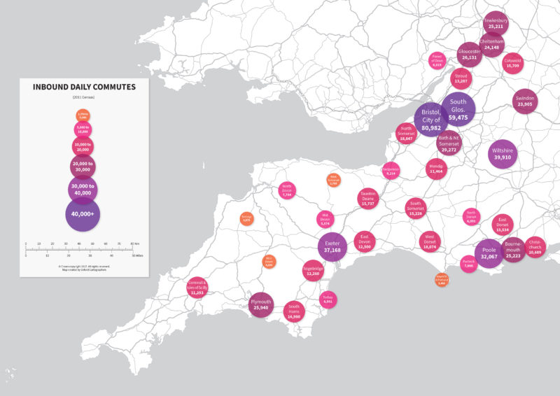
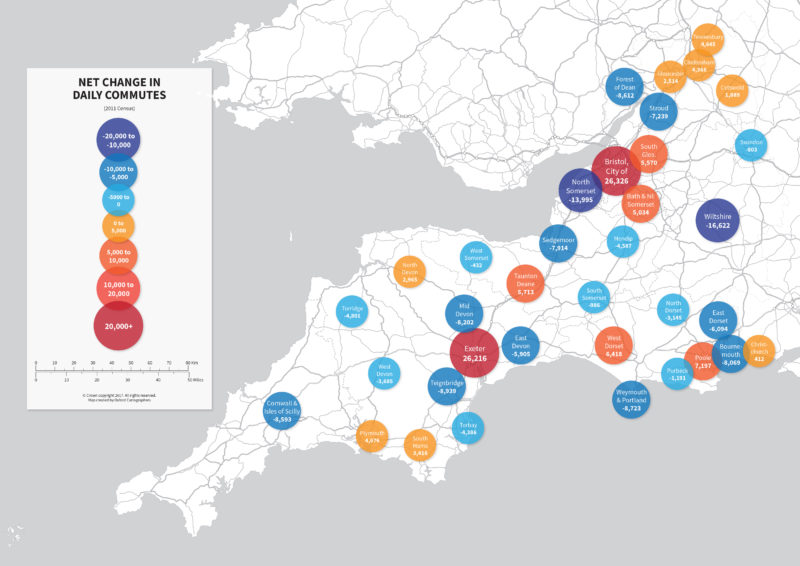
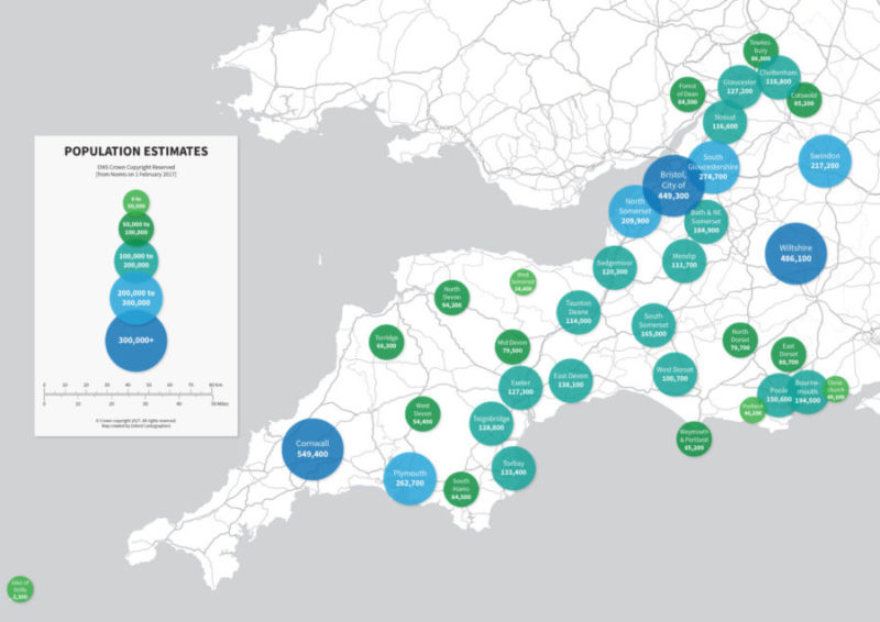
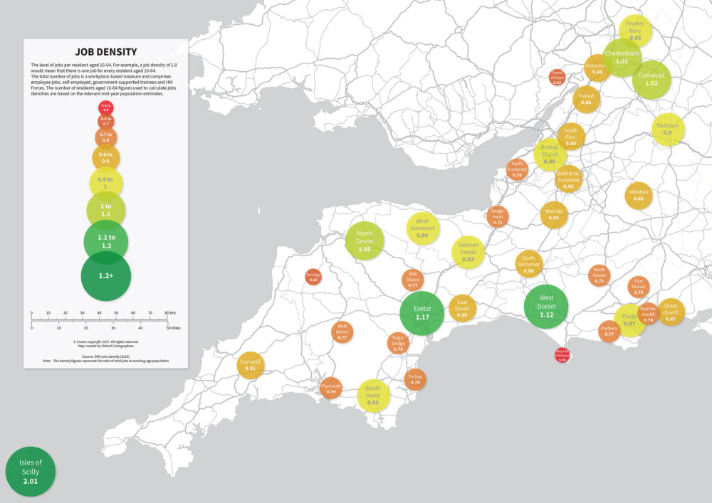
Having worked with Oxford Cartographers on a previous project, GCC asked us to help design a range of thematic maps that would best fit their needs whilst incorporating the map design from the previous project. GCC provided us with the census information which was then converted and displayed onto the map in a simplistic way to ensure the user would interpret the data quickly and effectively.
Below are a few examples of the census maps created where the maps display information for Job Density, Population Estimates, Inbound Daily Commutes & Net Changes in Daily Commutes. Please click on the maps to enlarge.



Leave A Comment
You must be logged in to post a comment.